Brazos Valley Cyclists

  • Facebook
  • RSS
  • Twitter
  • Home
  • About Us
  • Mailing Lists
  • Rides and Routes
    • Weekly Rides
    • Routes
    • Periodic Events
    • Hazards
  • Blog
  • Links
  • Calendar
  • Community
    • Metropolitan Planning Organization
Home Archives for Routes

Don Gilman March 4, 2019

MPO Wants your Feedback on Future Cycling/Pedestrian Routes

The Active Transportation Advisory Panel (ATAP) of the MPO has developed a draft Active Transportation Master Plan. The plan is intended to serve as a guide for the development of a connected bicycle and pedestrian network in Brazos County. The plan includes facilities for all types of users, from recreational users to the highly confident bicycle rider.

We would like to receive your input on the plan. Two maps (one 11×17 the other a full size map for someone with a plotter) are linked below. If you have any thoughts, questions, concerns or other feedback please submit your comments here on our website. The ATAP will review all comments and make changes based on your feedback.

The map in two sizes:

Full Size (for plotter):

https://www.bcsmpo.org/DocumentCenter/View/473/Draft-BCSMPO-Regional-Bicycle-Pedestrian-Plan-Full-Size-20190304?bidId=

11×17 (harder to read)

https://www.bcsmpo.org/DocumentCenter/View/474/Draft-BCSMPO-Regional-Bicycle-Pedestrian-Plan-Tabloid-20190304

Comments requested:

https://www.bcsmpo.org/FormCenter/Contact-Us-5/Submit-a-Comment-44

Filed Under: Bryan/College Station, Commuting, Government Engagement Tagged With: 2040, Cycing, pedestrian, Routes

Don Gilman September 5, 2017

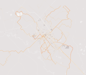
Texas, Brazos County, Bryan and College Station use Strava Heat Maps

TXDOT licensed Strava data (near real time) for the entire state and is conducting training so our local municipalities can leverage this data.

Just last week the MPO sponsored our local governments to draw out the near and long range cycling routes that connect the cities and Brazos County. We used the 2016 Strava Heat map for that first pass.

While there are limitations (i.e. mostly represents recreational distance cyclists who use Strava) it is a larger set of geo-coded data than they could get any other way.


Strava Heat Map - B/CS/Brazos

(C) 2017 Strava

Heat Map – B/CS/Brazos

Filed Under: Advocacy, Bryan/College Station, fitness, Government Engagement, Rides/Events Tagged With: Brazos County, Bryan, College Station, Research, Routes, Strava, TXDOT

Copyright © 2025 · Brazos Valley Cyclists · Some Rights Reserved

Copyright © 2025 · Streamline Pro Theme on Genesis Framework · WordPress · Log in